
Courtesy of Steve Jurvetson
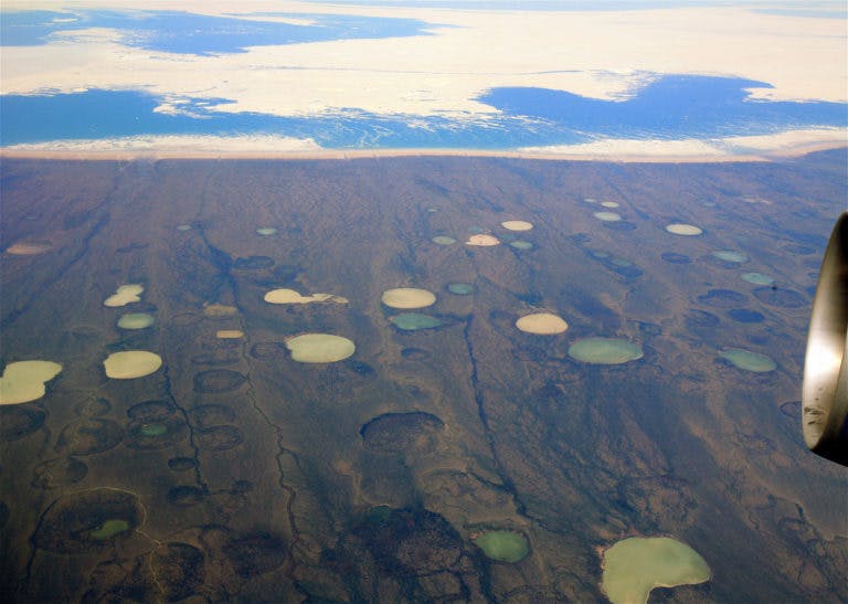
Terrain alterations caused by permafrost thaw due to a warming climate are damaging the “rich archaeological record of the Arctic Coast and (is) impacting sites used today by traditional harvesters.” (15) To evaluate the extent of these effects, Thomas D. Andrews et al. have developed a tool for assessing the risks of thawing permafrost. Their research is focused in the Gwich’in region situated on the northwestern border of Northwest Territories, including parts of Nunavut and the Arctic Ocean.
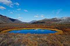
The risk assessment tool evaluates retrogressive thaw slumps: “disturbances that form in sloping terrain underlain by ice-rich permafrost.” (16) Thaw slumps are common to “coastlines and the shorelines along lakes, rivers, and streams,” (16) and are frequently observed in the Gwich’in region. The researchers claim that rising average temperatures and increased summer rainfall is accelerating thaw-slumping, affecting terrestrial and aquatic life, as well as damaging the cultural resources of the region. Cultural resource managers of the study area, who work with limited budgets, can use this tool to identify the high-risk zones relevant to their preservation efforts.
The assessment tool measures the density of retrogressive thaw slumps in 15 km2 blocks and the traditional land use data from the Dene Mapping Project to predict the
risk that permafrost thaw will affect particular cultural resources in the Gwich’in region. Of the 1033 blocks studied, 804 blocks had no risk, 148 blocks had low risk, 47 blocks had low-medium risk, 15 blocks had medium risk, 15 blocks had medium-high risk, and 4 blocks had high risk. The area that stands the greatest risk of losing cultural resources is along the Peel River, extending from the Peel Plateau southward into Yukon Territory.

Courtesy of Keith Williams
Limitations exist on the functionality of this tool. The researchers caution the tool only represents modern Gwich’in land use. As pre-contact Gwich’in people may have had different land-use habits that were lost due to a lack of archeological records, the assessment tool only captures their more recent land-use activities. It also does not account for heritage or land-use records of other Indigenous groups that may have used the study area. The data used to develop the tool also had inaccuracies where rapid revegetation occurred in disturbed areas. To address these limitations, the researchers recommend using this tool to identify broad areas of risk, to which cultural resource managers can apply more precise assessment instruments for a more accurate evaluation of those areas.
As the effects of climate change reshapes the landscapes in northern Canada, the researchers believe systems that update the available information on land disturbance and heritage sites will bring greater precision to managing heritage resources.
This is a summary article written by Imtihan Ahmed. For more information, please access the full document:
Thomas D. Andrews, Steven V. Kokelj, Glen MacKay, Julie Buysse, Ingrid Kritsch, Alestine Andre, and Trevor Lantz
Permafrost Thaw and Aboriginal Cultural Landscapes in the Gwich’in Region, Canada.
APT Bulletin Journal of Preservation Technology 47 (1): 15-22. 2016.